Back on the Via Alpina, but this time a part of the “red trail”

DSCN1928

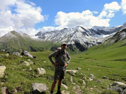
At Gross Furgga on the Austrian border, looking ahead into Switzerland (toward Schesaplanahütte).

This blog is devoted mostly to the Via Alpina “green trail” which extends East-West across the Alps in Switzerland.  (At the bottom of this post, I’ll repeat how to find my 2013 and 2016 posts about hiking the “green trail”).  But in this post, I’ll mention my July-August 2019 hike (with my wife and daughter) on just a few stages of the Via Alpina “red trail” through Liechtenstein, a small part of Austria and the Prättigau region of the Swiss canton of Graubünden.  The red trail is by far the longest of the five Via Alpina routes, beginning in Slovenia and ending in Monaco.  In 2019, we decided to hike just a few stages of that extremely long trail.  

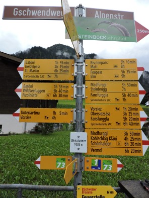
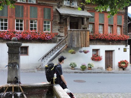
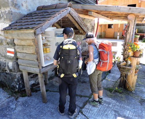
We began at the end of July in Liechtenstein at Berggasthaus Sücka, which is located literally right on the red trail.  We got there via train and bus from Zürich airport (train from the airport to Sargans, Switzerland, then Liechtenstein bus to the Steg tunnel bus stop in Liechtenstein.  It’s just a third of a mile hike uphill from the bus stop to the Berggasthaus).  The Berggasthaus was clean, neat and comfortable.  Adjacent to the lodgings is a working dairy farm, where cows are brought in very early each morning and in the evening for milking (complete with jangling cowbells).  However, the older woman proprietress was very brusque (sometimes to the point of rudeness), and never particularly accommodating.  Dinners were very good.  Breakfast was adequate.  When we asked the proprietress to make us lunch packets for the next day (typical in alpine huts and hotels) she refused, and instead told us to make our own sandwiches from the bread, cheese and meat on the breakfast buffet table (and then charged us quite a bit for that).

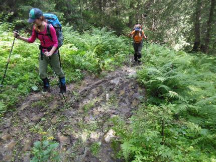
We spent two nights at Sücka.  On our first full day there, we backtracked on the Via Alpina red trail (without our packs, which we left in the Berggasthaus) to day hike the previous stage of the Via.  That took us through the Fürstensteig (Prince’s Climb), a famous trail segment carved out of the rocky cliffs in 1898.  Unfortunately, the weather was dark (either rainy or foggy) all day, so our photos don’t fully reflect how spectacular the trail really was.  Suffice it to say that this was the most exciting trail I’ve ever hiked in more than 50 years of hiking.  Narrow tread, breath-taking exposure (one side drops off precipitously all the way down to the Rhine Valley), steep scrambles, plank bridges over deep gaps.  Tons of adrenaline-fueled fun!  Plus, we were all alone on the trail, which made the experience even more enjoyable.


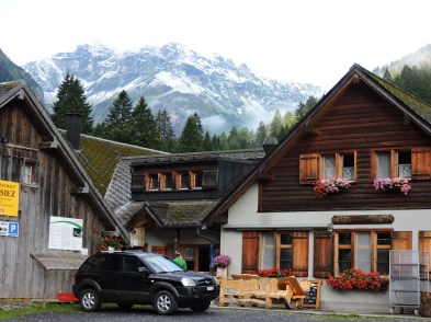
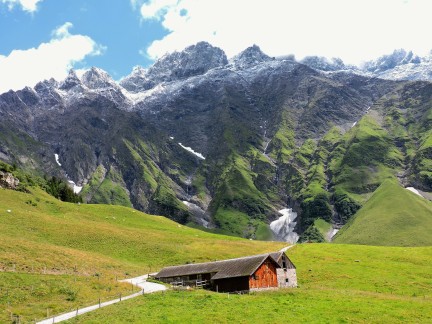
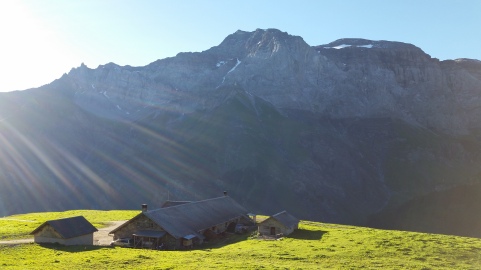
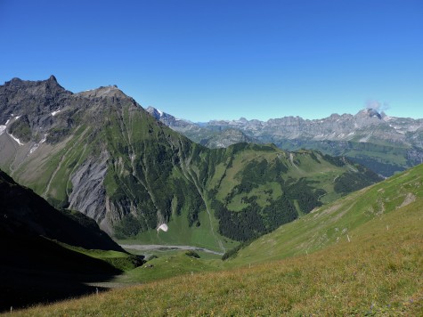
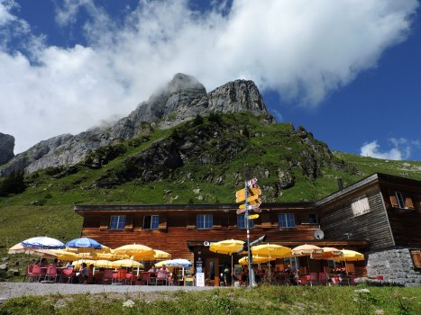
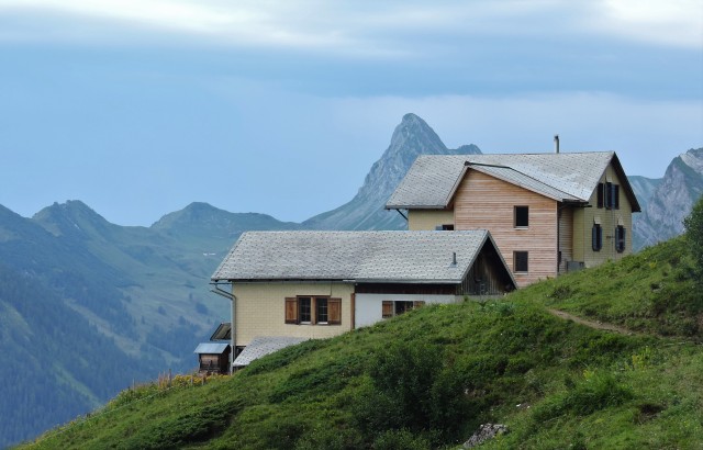
The following day, we hoisted our packs and proceeded ahead on the Via Alpina red trail to Pfälzerhütte, owned by the Liechtenstein Alpine Club.  What a location!  It straddles the knife-edge border between Liechtenstein and Austria, with stunning mountain views in all directions.  There are several very enjoyable opportunities from Pfälzerhütte for day hikes and peak bagging.

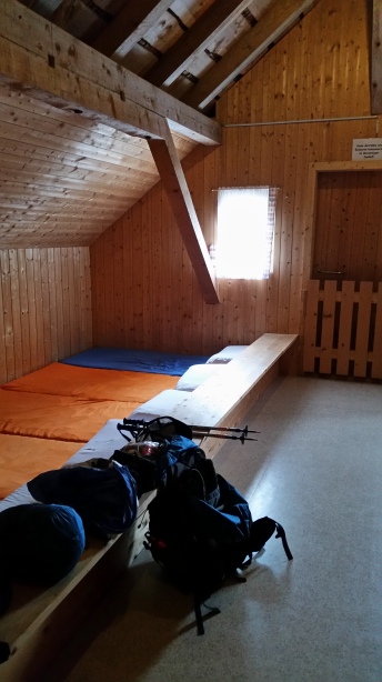
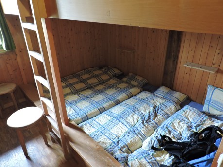
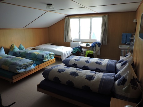
The hut offers both rooms (with bunk beds) as well as a massenlager dormitory (with 51 spaces).  Compared with other alpine huts we have stayed in, the food was fairly good (but not great).  The exception was the freshly-baked goodies available for mid-afternoon snack (cherry, cheese and apricot or carrot cake, as well as apple strudel), which were out-of-this-world.

DSCN1702

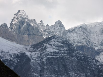
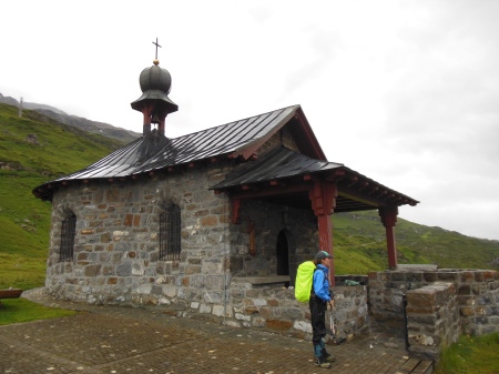
Pfälzerhütte, Liechtenstein

The three youngest members of the hut staff were extremely cordial and hospitable. However, the older woman who was the “hut warden” treated us rudely.  [So…while in Liechtenstein, two older women in charge of lodgings seemed hostile toward us.  Why?  Our daughter speaks German very well, and even my wife and I speak a little German.  Were these Liechtensteiner older women biased against Americans?  Or against English-speakers in general?]

DSCN1916

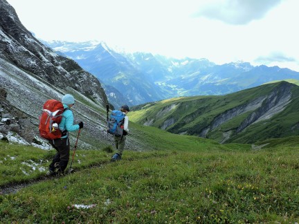
On the Via Alpina red trail in Austria, headed for Switzerland.


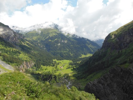
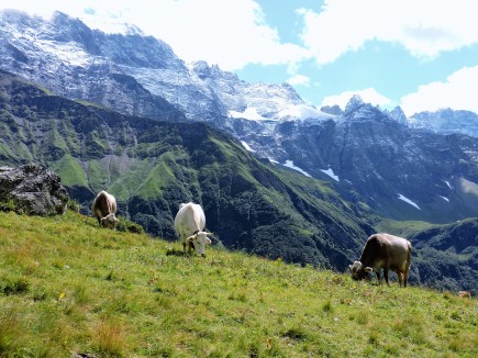
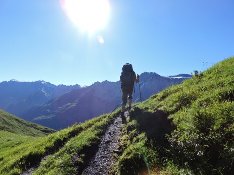
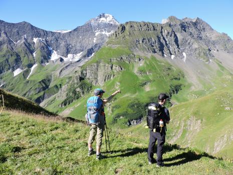
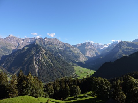
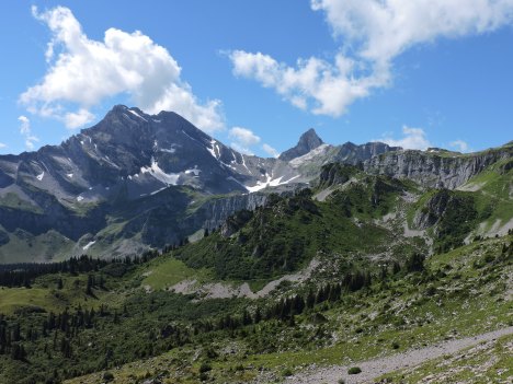
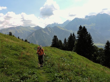
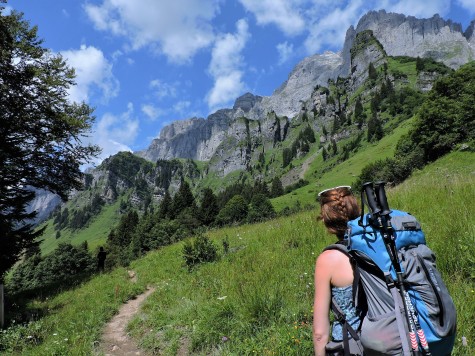
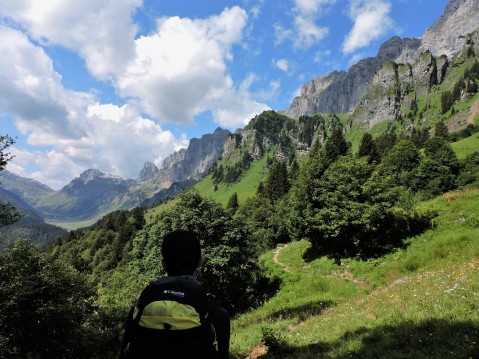
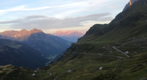
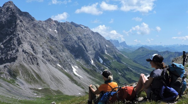
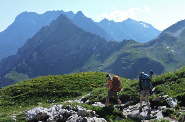
Proceeding with the next stage of the Via Alpina red trail, we passed through a small corner of Austria and then entered Switzerland.  The views were absolutely spectacular, so much so that we stopped often just to take it all in.  Once while doing so, we heard the sound of an alphorn from far off, playing a traditional tune.  Only in the Alps….

DSCN1937

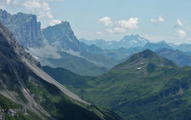
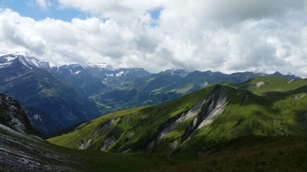
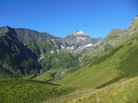
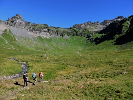
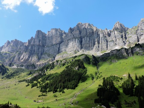
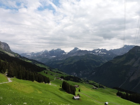
The route of the Via Alpina red trail follows the foot of the line of peaks on the left (known as the Alpstein) and crosses the many saddles visible in the middle of the photo.  

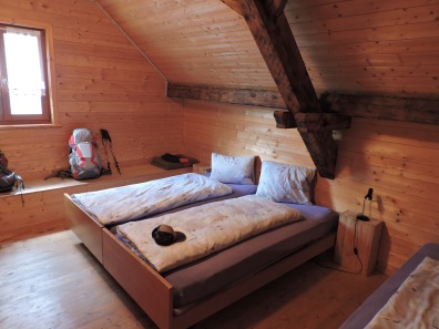
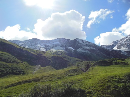
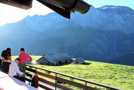
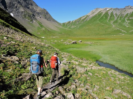
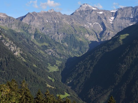
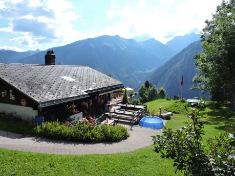
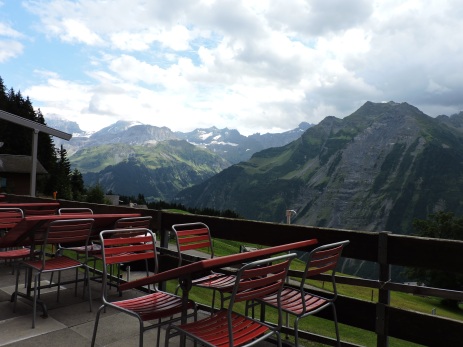
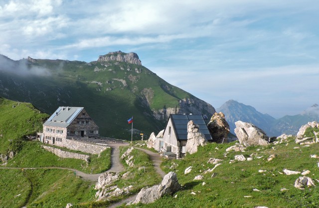
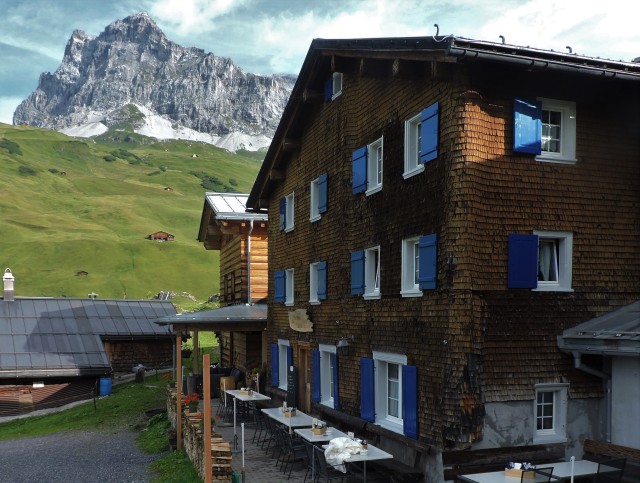
This stage of the trail is totally above timberline, making for nonstop alpine views.  The stage ends at Schesaplanahütte, owned by the Swiss Alpine Club.  The hut is situated high on a ridge, allowing excellent views in various directions.  Both simple bedrooms or massenlager are available.  The entire hut staff was especially professional, welcoming and generous.  The food was plentiful and of the highest quality.   Schesaplanahütte offers rooms with beds or massenlager.  We stayed three nights, making day trips in the area.
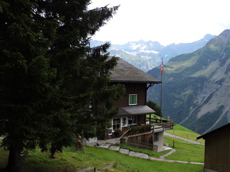
DSCN1956

Schesaplanahütte

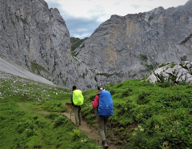
By the time we were ready to move on to the next stage of the Via Alpina, we were faced with a decision.  We’d been dodging rain and lightning for several days, and this particular day’s forecast was sketchy.  The route ahead was entirely above treeline, and we didn’t want to be caught out in the open during a thunderstorm.  After consulting with the hut warden, we decided to go for it.

DSCN1977 (2)

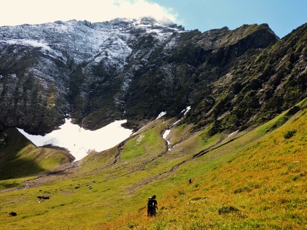
Approaching the Schweizer Tor (Swiss Gate) on our way along the Via Alpina red trail toward Berghaus Sulzfluh.

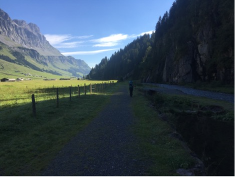
All morning as we hiked along, nasty storms approached from the west and then veered off and missed us.  But at mid-day we passed the Schweizer Tor (the Swiss Gate that reminded us of something from the Lord of the Rings movies), and the wind began to howl; we realized then that we weren’t going to avoid the storms after all.  The rain hit us soon thereafter, and continued full blast for the rest of the day.  The trail was in poor condition to start with: the tread was a good 10 inches below the surface of the surrounding ground, and frequently braided.  With rain pelting down, the trail flowed like a stream with water several inches deep.  We passed Carschinahütte (which, although typically the end of this stage of the Via Alpina, was full-up), and arrived instead at Berghaus Sulzfluh, drenched to the skin.  The young ladies in charge at Sulzfluh welcomed us very warmly, and we enjoyed an excellent dinner and then a comfortable sleep (in an historic room lit by candle).  The next morning we made our way down the valley to St. Antonien, where our journey on part of the Via Alpina red trail came to an end.

DSCN2001

Berghaus Sulzfluh, on the morning after the storm.

If you plan to hike these stages of the Via Alpina red trail during the high season, reserve your hut accommodations well in advance (they were packed when we were there).  Also be aware that neither Pfälzerhütte nor Schesaplanahütte accept credit cards (you must bring cash!).  I know of no guidebook to the red trail in English.  We used Swisstopo “wanderkarte” 1:50,000 maps for the Montafon (238T) and Prättigau (248T) regions.  And pray for clement weather, especially when crossing the highest passes.

Interestingly, while on this trek we never saw any other native English-speakers: no other Americans, Brits, Canadians, Aussies or Kiwis.

A reminder about how to use this blog to learn about the other Via Alpina, the “green trail”:  we hiked the green trail across Switzerland in two trips.  In 2013, we hiked west to east, from Lenk to Engelberg.  Then in 2016, we hiked the trail from east to west, from Mels to Engelberg.  So to read about hiking the green trail, scroll down until you see my stage-by-stage “trail diary” posts from 2013 and 2016. 

Happy trails! 

Posted in Backpacking, Hiking, Mountains, Switzerland | Tagged | 2 Comments

Summer 2019: back to the Via Alpina yet again (this time, the Red Trail)

To date, this blog has documented my travels on the Via Alpina green trail across the Swiss Alps (see details in the next blog post below).  But in 2019 (beginning July 29 and ending August 14), my wife and I are heading back to the Alps to hike a portion of the epic Via Alpina red trail.  Although the red trail begins in Trieste and continues 1,500 miles across the Alps and through eight countries to Monaco, we’ll hike just part of the trail.  We’ll begin in Liechtenstein and hike through portions of Switzerland and Austria, ending near the Italian border.  If you’ve hiked that stretch of trail, I’d be interested in any tips you might have.

In the meantime, I hope that this blog provides helpful information about the Via Alpina green trail.  And if you’ve hiked the Via Alpina green trail, please post your trip report here!   The next post below explains how to use this blog.  See you on the trail!

Posted in Backpacking, Hiking, Mountains, Switzerland | Leave a comment

Learn about the Via Alpina green trail, and share your trip reports!

This blog shares my experiences hiking the Via Alpina green trail across Switzerland.  To read descriptions of the western portion of the trail, scroll down to see my “trail diary” posts below from 2013 (when we hiked from Lenk to Engelberg, west to east).  To read descriptions of the eastern portion of the trail, see my “trail diary” posts below from 2016 (when we hiked from Mels to Engelberg, east to west).  Each “trail diary” includes photos; to see the photos in a larger size, just click on them.

Feel free to post (in the comments box) any questions you may have.  I’m happy to answer questions, offer advice and share tips about this world-class hiking trail.

And if you have hiked the Via Alpina green trail, please share your trip reports here!  What did you encounter?  Anything that other hikers should be warned about?   Any good adventure stories?  Thanks for your help.  My friend John Brody from California hiked the Via from Lenk to Linthal in August 2017 with his daughter Gabby.  He kindly provided me with updated trail information, which I have added to my “trail diary” posts.

P.S.  The trail segments described in this blog are not the only way to hike the Via Alpina.  You may choose longer or shorter segments. Different guidebooks recommend different ways to “split up” days on the trail.   I and my hiking partners chose these particular segments for a variety of reasons (to enjoy some slower days, to stay at particular huts, to deal with health issues, etc.).  As we say in the US, “Your mileage may vary.”

P.P.S.  I am adding this post-post script on April 8, 2018.  My wife and I are considering hiking a portion of the Via Alpina RED trail from Sücka, Liechtenstein through portions of Austria and Switzerland to the Italian border.  So I am now researching the red trail (after having hiked the green trail).  If we go, it would likely be in August, 2019.  Have any of you hiked that portion of the Via Alpina red trail?  So far, I have not found any guidebooks for the Via Alpina red trail.  As you can tell, we are hooked on hut-hopping in the Alps!


Posted in Backpacking, Hiking, Mountains, Uncategorized | 4 Comments

Trail diary: Mels to Weisstannen

Back to the Via!  In 2013, we hiked the western half of the Via Alpina green trail from Lenk eastward to Engelberg.  In mid-August 2016, we returned to Switzerland to hike the eastern portion of the Via, this time traveling from Mels westward to Engelberg. Technically, the Via begins farther east, in Liechtenstein.  But since most of that trail segment looked uninteresting (flat land, urbanized areas and a motorway), we decided to begin in Mels, right at the foot of the mountains.  We rode the train from Zurich to Sargans, and then the bus from Sargans to Mels.

Mels is not particularly friendly to hikers, since it is not a resort area.   There are few lodgings or restaurants.  We stayed at the Hotel Schweizerhof, which is conveniently located a block or so from both the bus stop and the Via. Our rooms at the Schweizerhof were excellent, but the service was poor (cranky and inattentive).

The Via Alpina’s route from Mels to Weisstannen is rural and serene. But because of the rainy weather, our visibility was limited. The Via emerges from Mels on a narrow road that climbs steeply through a sleepy residential area.  The road becomes unpaved, and then the Via devolves into a rough (and apparently very, very old) trail dominated at points by rocks.  Climbing steadily, the Via finally emerges in a rural valley and rolls along through dairy farms and forests on a more gradual incline. Sometimes the Via follows quiet country roads, at other times it uses narrow trails that wind through pastures.  We were overjoyed to be walking in the Swiss countryside again, with all the associated sounds, smells and sights.  The area is mostly Catholic, and the Via passed trailside crucifixes and a rocky grotto devoted to the Virgin Mary. Waterfalls were running full and loud.

In English, Weisstannen refers to the Silver Fir tree, and we saw plenty of fine forests as we hiked along.

We met no other hikers all day.  In fact, we saw very few people at all (occasionally a farmer, some small children playing).  By late afternoon we entered the tiny village of Weisstannen (no stores) and easily found Hotel Gemse right along the trail.  (The German word Gemse refers to the animal we call chamois in English)  The proprietress welcomed us warmly.  Although she spoke no English, she was very cordial and accommodating throughout our stay.   Our rooms were spotlessly clean, neat and spacious.  We dined downstairs on traditional Swiss fare (four courses), with Swiss Volksmusik in the background. Our 2016 Via Alpina trek had begun.  We were in Canton St. Gallen, heading west into the heart of the Alps.  Two weeks later we would end the trek more than a hundred miles away, at Engelberg in Canton Obwalden, after passing through two other cantons.  We crossed our fingers, knocked on wood and wished for more clement weather in the days to come.

This leg of our route involved eight miles of hiking and 1,800 feet of elevation gain. Nearly the entire trail was either in forest or within close proximity of trees. Signage was excellent.  Between Mels and Weisstannen, there are virtually no hiker services.  It is possible to take the bus from Mels to Weisstannen if necessary.

(click on photos to enlarge)

lcs-photo-of-weisstannental

Trailside scenery in the lush Weisstannental.

bc-weisstannental

Yours Truly in the (very wet) Weisstannen valley.

DSCN0204

Weisstannen church

DSCN0200

Hotel Gemse


Posted in Backpacking, Hiking, Mountains, Switzerland | Leave a comment

Trail diary: Weisstannen to Alp Siez

The hike over Foopass is significant, no matter how you approach it.  From Weisstannen heading west, crossing the pass involves more than 14 miles of walking and 3,700 feet of elevation gain (and as much elevation loss).  So because this was only our second day on the trail, and the weather was rainy, we decided to break up the ascent a little.   First, we’d sleep in late at Weisstannen, dry out our gear, and then spend a leisurely day wandering the short distance from Weisstannen to Alp Siez and waiting for the weather to clear.  Then on the following day, when sunnier weather was predicted, we’d make the big push over the pass to Elm.  This strategy would reduce the length of the day’s climb over the pass.

As we left Weisstannen for Alp Siez, the weather was once again cool and rainy. The Wanderweg-style trail was gradual and wound through woods and pastures, along a rushing stream (the Seez), and past hunting stands and dairy cows. Where beside the trail there appeared to be wild rhubarb, I stopped and took a swig from a bottle of Rivella that I had bought earlier.  Rivella, the quirky Swiss national soda pop, uses milk whey as a base and comes in several different flavors.  This time I had opted for the rhubarb flavor.   Aamächälig!  

For about a mile, the route of the Via coincided with a new nature trail (the Steinbock Lehrpfad or “ibex learning trail”) that turned out to be lots of fun. This nature trail provided numerous well-designed placards providing intriguing details about the local fauna (such as ibex), flora, geology and history.   We took our time, lingering to read the placards and using our guidebooks to identify flowers and trees.  Note: this new nature trail does not show up on the Swiss Wanderkarte topographical maps.

We also encountered a “family grill” site, fully equipped for the public to use for barbecuing (with utensils neatly hung up, kindling and firewood precisely stacked and neatly printed instructions about how to light the grill and clean up.  Oh so Swiss.).  Once again, we saw no other hikers all day.

After wandering through forest and along the stream, we reached Alp Siez in the early afternoon.  It’s an attractive and rustic restaurant and cheesemaking facility in a remote rural area, with simple lodging for hikers.   Once again we were greeted warmly, although none of the staff spoke English.

Marti and I stayed in a touristenlager room: very simple, with rustic beds, a small window and a bench.  Andrew and Laura stayed in the matratzenlager, where in one room there were 16 mats lined up, sardine-like.  (See my “Tips for Via Alpinists” page on this blog for more info on matratzenlager)  The common toilet, sink and shower facilities were down the hall. Everything was very neat and clean.  There were only two other guests that night.

Dinner was served in a small room with a huge window displaying the cheesemaking facility, where we watched cheesemaking in progress.  The tables were rustic, with benches. The meal that night began with a superb mixed salad, followed by Alpenmagaronen (a Swiss take on macaroni and cheese), and topped off by plum cake (all homemade).

We enjoyed a quiet and comfortable night, and eagerly looked forward to better weather tomorrow as we tackled Foopass.

Today’s hike covered only three miles and involved a mere 600 feet of elevation gain.  Almost the entire trail was in lush forest.

(click on photos to enlarge)

DSCN0205

Wegweiser (trail sign) outside Weisstannen.  Note the Via Alpina sign near the bottom (blue and green, with a number 1).

dscn0297

My trailside refreshment.

DSCN0206

Everything you’d need for a trailside barbecue.

dscn2837

My son takes a selfie with a Steinbock (Ibex) exhibit on the nature trail.

dscn2849

The trail was never far from the rushing stream.

DSCN0210

Alp Siez

DSCN0207

Touristenlager room at Alp Siez.

20160810_145025

Matratzenlager (massenlager) at Alp Siez.

Posted in Backpacking, Hiking, Mountains, Switzerland | Leave a comment

Trail diary: Alp Siez to Elm

If hiking the Via Alpina green trail from east to west, Foopass is the first pass you encounter.  As noted in my previous post, we decided to leave for the pass from Alp Siez.  The hike from Alp Siez over Foopass to Elm involves 12 miles of walking plus 3,105 feet of elevation gain and 3,700 feet of elevation loss.  A very substantial day of hiking. Fortunately, we enjoyed sun all day.  After a simple but hearty breakfast at Alp Siez, we bought homemade “alp cheese” from our host and then hit the trail.   At one point, we passed signs warning that because the Swiss Army sometimes conducts exercises nearby, hikers should not pick up unexploded ordnance (!)  (Note:  other blogs and hiking guidebooks warn that the Army does indeed sometimes conduct live-fire exercises here during hiking season.  Fortunately, that was not happening when we hiked through here)  Soon we were winding our way through very lush forests thick with wildflowers and tall ferns (reminiscent of the Pacific Northwest here in the US), then into higher country.

By mid-morning, we were greeted with genuine alpine views of peaks and ridges, with fresh snow on the highest areas.  The trail now involved consistent (and sometimes very steep) uphill grades, and certain portions of the trail were muddy and VERY badly eroded by the dairy cows who were pastured in the area. There were more waterfalls than we could count, each running at full force after two days of rain.

We were now in true alpine terrain, and spent several hours hiking above the treeline, with vistas far and wide.  Even at high elevation, the vegetation was very lush and green. Dairy cows were grazing nearly everywhere, and we passed some remote farm buildings in the area of Fooalp.  Eventually we reached the saddle of the Foopass, where new snow dusted the ground and a cold wind forced us to put on our heavy jackets, caps and gloves.   To this point we had encountered only three other hikers, plus a herdsman out to check on his cows. From the pass onward, we entered new territory and a new canton (Glarus).

One thing we enjoy about hiking the Via is the experience of standing at a pass. We look back at the country we have spent the past days hiking through, smiling in satisfaction at what we’ve accomplished so far.  And we also gaze forward into new country, noting with anticipation the ranges and drainages that we will cross in the coming days.   From Foopass, we saw unusually jagged ridges of rock ahead.

The descent from the pass was long, and at points very slippery (probably a dangerously slick descent in rainy weather).  There were even more waterfalls, and we passed first through alpine country, then pastures and eventually forests.  Finally the town of Elm was visible in the distance.

We stayed at the Hotel Elmer, in the center of town and not far from the trail. The front desk staff was very cordial and efficient, and spoke excellent English. Our room had four beds and was very clean, well appointed and comfortable. We couldn’t dine at the hotel that night because it was feeding a contingent of Swiss soldiers on manuevers.   So we ate at the nearby Gasthaus Sonne, which had a very attractive and traditional dining room and offered excellent meals.

Elm is very scenic and quiet, a cross between a hiking/skiing resort and a farm town. Winter must be their high season, because there were very few visitors there in mid-August.  There is a small and friendly grocery store, an ATM, a helpful tourist information office, a delightful bakery and a very cordial hiking/skiing equipment store.

We enjoyed a quiet and very restful night.  It was so good to spend a day hiking in the high country, and have one pass under our belt.

While on the trail, we were above treeline perhaps 70 percent of the time.  The route to the pass was not particularly exposed or precipitous (just a long uphill grind).  Trail signage was excellent.  Unlike some of the western portions of the Via Alpina we hiked in 2013, there are virtually no hiker services along the trail over Foopass.  No huts or mountain hotels or restaurants, no ski lifts, no rail lines, no roads.  Just a handful of remote farms.  The only accommodation along this portion of the trail was a simple hut about a mile or so west of Alp Siez.  For the remaining 10 miles to Elm, you’re on your own.

(Click on photos to enlarge)

dscn2866

Beautiful ferns, but terrible mud.

dscn2918

Looking back from about the four mile mark.

dscn2963

About halfway to the pass.

DSCN0227

Andrew on the ascent to Foopass

DSCN0233

Yours Truly on the last mile to the pass, with fresh snow on the ridges.

DSCN0253

Viewed from the pass.

DSCN0245

Beginning the descent from the pass.

20160811_131959

Looking forward, from Foopass, toward Elm.

DSCN0275

About halfway down from the pass.

DSCN0267

A trailside view on the way to Elm.

DSCN0293

In Elm.

Posted in Backpacking, Hiking, Mountains, Switzerland | Leave a comment

Trail diary: Ober Erbs (Elm) to Braunwald

After reaching Elm, the weather turned wet and cold again.  Plus, I became ill with a nasty head cold and felt terrible.  So we decided not to hike today, but instead take the bus to Skihütte Ober Erbs, a hut located high on a shelf above Elm and the valley.  At Hotel Elmer the night before, our hosts had given us a “tourist card” that entitled us to free bus rides in the area.  The bus ride was quite an experience, winding up numerous hairpin turns.   According to guidebooks, Via Alpina hikers often take this bus to Ober Erbs and make their start up the trail to Richetlipass from there.  This eliminates about 6.5 miles of walking and 2,100 feet of elevation gain.

In most respects, Ober Erbs is a delightful high altitude hut.  The views of the nearby peaks were superb, and the architecture of the hut itself was traditional. There was a pleasant common room in which to pass time while rain showers continued outside. And our sleeping accommodation was very clean, neat and well-kept.  We had matratzenlager in a small room: four mats on the lower level, with four others (which we did not use) on a bunk level above.  The room also had a small window and one chair.  Shared WCs and wash basin were on the other side of the common room.

However, we encountered two unfortunate things that somewhat impacted our experience at Ober Erbs.  One was that the proprietress seemed totally overwhelmed by the number of guests.  The other was that, on Friday and Saturday nights, locals come up here to drink and socialize.  As a result, at times the common room was extremely crowded and boisterous. In fact, a group of young men talked and laughed loudly there until 1:30 am.  So, except for a few hours in the afternoon, we did not enjoy the usual peace and quiet that Swiss alpine huts are known for.

Anyhow, the next morning dawned bright and sunny, and we were happy to get back on the trail.  The trail climbed steadily (and sometimes steeply).  When you start your hike at Ober Erbs, you’re already above timberline from the beginning (and you just keep going up from there).  The views are outstanding at every turn: peaks, ridges, wildflowers, streams and even a high-altitude wetland.  We encountered very few hikers, and (even though this was a Saturday) were alone most of the time.

As with Foopass, the trail to Richetlipass is not particularly exposed.  It just winds up and up at a consistent grade.

From the pass, we were excited to look ahead to new country.  From Ober Erbs to Linthal (in the valley below) is a total of nine miles and involves a relatively moderate 1,686 feet of elevation gain over the pass. But the descent is an absolutely grueling 4,839 feet!   For the first several miles, the drop is relentless and mostly very steep.  As the guidebooks say, descending this part of the trail in wet weather could be very tricky. But eventually the trail levels out somewhat.

There are no hiker services from Ober Erbs until well over the pass, into the rural Durnachtal valley above Linthal, where two very rustic farms offer simple matratzenlager accommodation for hikers. Interestingly, I am not aware of any map or guidebook that mentions these.  One of the farms called Alp Vorderdurnachtal (which has its own website at durnachtal.ch) also provides a very nice self-service kiosk (decorated in traditional Swiss folk style) that sells alp cheese and other dairy products plus apple juice.  It’s right on the trail, and a welcome sight for hungry or thirsty hikers.

After spending nearly the entire day above timberline, the trail drops into forested areas and then runs through a tunnel before entering the town of Linthal.  Although the Via then proceeds to ascend the very steep slope to Braunwald, most hikers choose to access Braunwald by the funicular instead (as we did).  The walk through Linthal to the funicular station was surprisingly pleasant.

Braunwald makes an excellent rest stop for Via Alpina hikers.  It’s car-free, with streets dedicated to pedestrians (plus an occasional tractor, electric cart or horse-drawn wagon). Located on a shelf high above the valley, Braunwald offers world-class views and plenty of peace and quiet.  There are two grocery stores, a hiking store, a post office, an ATM and a bakery.

(There are nine car-free alpine resorts in Switzerland, and the Via Alpina green trail passes through three of them: Mürren, Wengen and Braunwald)

In total, our day involved about 11 miles on foot (the hike over the pass, the walk through Linthal and then the walk from the funicular station uphill to our hotel in Braunwald). Signage was very good.  Probably 7 miles of the trail were in the open, above timberline.

We had now crossed two of the four major passes we would climb during our two-week trek on this part of the Via Alpina.  So far, both Foopass and Richetlipass had provided superb hiking, world class views, lots of elbow room and a feeling of relative “wildness” not found in many other areas of Switzerland.

(click on photos to enlarge)

DSCN0295

Matratzenlager at Ober Erbs.

20160813_075042

The view from Ober Erbs.

DSCN0308

Preparing to leave Ober Erbs.

DSCN0335

Just above Ober Erbs.

dscn3003

Still a long distance to the pass.

DSCN0347

More ridges to climb….

DSCN0356

The pass is visible ahead (note wetland to right).

DSCN0362

Passing through a beautiful cirque.

DSCN0371

The view Westward from the pass.

DSCN0402

Self-service trailside refreshments at Alp Vorderdurnachtal.  (Note white/red/white trail blaze on the barn wall)

DSCN0406

Braunwald ahead (on the high shelf above Linthal).   Two days later, we’ll hike from Braunwald to the left toward Urnerboden.

DSCN0440

The view from Braunwald.

DSCN0443

The view back toward Richetlipass.  That was a long descent….

horse-wagon-braunwald

Horse-drawn transport in car-free Braunwald.

Posted in Backpacking, Hiking, Mountains, Switzerland | Leave a comment

Trail diary: day hikes at Braunwald

As noted in my previous post, Braunwald (a car-free resort right on the Via Alpina) offers a perfect opportunity for a rest stop while hiking the Via Alpina. We spent two days there on our way across the Alps, and enjoyed some fun day hikes without our heavy packs.

Braunwald is located high on a shelf above Linthal (somewhat reminiscent of Mürren, another car-free resort we passed through while hiking the Via Alpina in 2013).  There are numerous hiking options, ranging from high-altitude peakbagging to easy Wanderweg-strolling through pastures.  On our first day, we rode a chairlift up to Gumen (high above Braunwald), where we lunched at the Berggasthaus (good Swiss comfort food, fantastic views, comfortable outside seating).  Then we made a couple of day hike sorties from there. First, we explored a Bergweg (mountain trail) angling uphill from Gumen toward higher country, with astounding views.  After circling back to Gumen for lunch, we then took the popular Zwerg Bartli trail aimed at kids, with a forest dwarf theme.  As the trail winds downhill toward Braunwald, it passes numerous dwarf-themed sites (dwarf forest, dwarf castle, dwarf village, dwarf tower and such, each with a long and delightfully unpronounceable name in Swiss dialect).  In the forests we saw surprisingly tall evergreen trees, reiminiscent of the Pacific Northwest in the USA.

The following day we simply wandered around Braunwald, which consists of a very small shopping area near the funicular station, with hotels, ski lifts, houses and farms spread far and wide over the several miles of green slopes above and beyond.  We stopped often to sit on trailside benches and soak up the peaceful view.

While in Braunwald, we stayed at Alexander’s Tödiblick Hotel.  The name refers to a gorgeous view of the Tödi, the most prominent peak in the area.  Although expensive, the hotel offered an excellent stay for tired hikers.  Our room had a double bed and two bunk beds, a bathroom and a balcony.  Two members of the staff spoke English, and everyone working at the hotel was very courteous, cordial and attentive.  Meals were outstanding, especially the buffet breakfast, which was by far the most generous and most varied we encountered on this trip.

After two delightful days in Braunwald, we were once again ready to hit the trail and get into new country along the Via Alpina.

(click on photos to enlarge)

DSCN0456

Berggasthaus Gumen.

DSCN0454

Superb day hiking country.

DSCN0455

Views across the valley.

dscn0435

More peaks visible across the valley.

Posted in Backpacking, Hiking, Mountains, Switzerland | Leave a comment

Trail diary:Braunwald to Urnerboden

It was the best of trails, it was the worst of trails….

The day began with several miles of truly world-class hiking.  As we left Braunwald on the Via Alpina, the pastoral atmosphere was almost too good to be true:  greenery, peace, quiet and traditional Swiss farms.  The trail here was rated as a Wanderweg: the grade was gentle and the trail surface was smooth, making for delightful walking. We had plenty of elbow room.  Then the trail snaked through thick forests, with some steep portions.  We passed Bergrestaurant Nussbüel, a very scenic and peaceful stop for a meal, snack or drink.  By mid-day we emerged into a new valley, with absolutely spectacular views of jagged mountain ridges all around.  We reveled in the scenery and enjoyed being virtually alone on the trail.  Far in the distance we could see Klausenpass, which we would cross the following day.  “It just doesn’t get much better than this,” we said, as we enjoyed a trailside picnic lunch of local cheese and sausage, fruit and chocolate.

After lunch, the trail dropped far down the mountain and changed character completely. For a quarter mile, the trail actually ran along the Klausenpass highway. There was no shoulder. So cars, buses and motorcycles passed within just a few feet of us as we hiked.  Then the trail dropped again, this time passing directly through an active gravel mining and crushing operation.  It was hard to find our way through the huge piles of gravel and the enormous machinery, but a kind truck driver pointed the way for us.  A very unpleasant half an hour of highway and industrial zone.

[Note: the maps and guidebooks I consulted in 2016 did not give us any warning about the gravel mining area.  The Via Alpina should be re-routed to avoid this really unpleasant site and to maintain a comfortable distance from the highway.  The new Kev Reynolds guidebook released in May 2017 (Trekking the Swiss Alpine Pass Route—Via Alpina 1) does now mention the gravel mining area as a problem area, but in my opinion does not offer enough of a warning.]

Fortunately, the trail eventually came into more pleasant country, running close by a rushing stream with plenty of wildflowers.  After a while we saw a sign indicating a very short side trail through a farm to Gasthaus Sonne, our lodging for the night.

Even though the Gasthaus is located right on the highway (and about a mile short of the town of Urnerboden), it is surprisingly quiet and pleasant.  Huge peaks rise up close behind the Gasthaus, and the view from our window was of the stream and trail.  The proprietress was very kind to us, even though she did not speak English.  The Gasthaus is old, traditional and very simple (but super clean, neat and comfortable).  Our rooms had sinks; the WC was across the hall and the shower was downstairs one floor.  We enjoyed a very pleasant, traditional Swiss dinner in the relaxing dining room that evening.

Today’s hike involved eight miles on the trail, with only 500 feet elevation gain and 600 feet of loss.   There were a few hiker services along the first half of the trail: Restaurant Nussbüel, plus a couple of farms offering very basic refreshments at picnic tables outside.  Signage was very good EXCEPT at the gravel mining site.

If we had known that the trail ran along the road and then passed through a gravel mining site, we would have caught the bus (at the place where the trail first encountered the road) and ridden it to Gasthaus Sonne.

(click on photos to enlarge)

dscn0468

Leaving Braunwald.

DSCN0470

Pleasant pastoral hiking outside Braunwald.

dscn0471

Restaurant Nussbüel, a perfect trailside refreshment stop.

DSCN0477

A view back toward Richetlipass.

DSCN0472

Encountering interesting geologic features.

DSCN0473

Klausenpass (tomorrow’s challenge) in the distance to the left.


DSCN0482

Ridgeline above Urnerboden and Gasthaus Sonne.

DSCN0485

A room at Gasthaus Sonne.


Posted in Backpacking, Hiking, Mountains, Switzerland | Leave a comment

Trail diary: Urnerboden to Ratzi

Today, we were supposed to have hiked the Via Alpina from Gasthaus Sonne, through Urnerboden and up to the top of the Klausenpass (the third of four major passes on our two-week trek). A little beyond the pass, we planned to abandon the Via Alpina temporarily and instead take the Schächentaler Hohenweg (high trail) out along the ridgeline to Ratzi (our destination for that night) and then beyond on the following day. We planned to take this detour because, for whatever reason, the Via Alpina drops instead to the valley, where it runs along the highway until it reaches Altdorf.  From what we saw on other hikers’ blogs, it appeared that staying high on the ridge would be more enjoyable than dropping down into the valley.

After a pleasant breakfast at Gasthaus Sonne, the proprietress very generously offered to drive us to the top of Klausenpass because heavy rain was forecast.  We didn’t relish the thought of hiking up to the pass in that rain, but declined her offer because it would have involved a thirteen-mile round trip drive for her.

We set out under overcast skies, and enjoyed the pleasant walk along the stream to the tiny hamlet of Urnerboden, which sits on a rise above the valley.  But as we got there, heavy rain began.  We put on our full rain gear and decided to take the bus up to the top of the pass, to avoid the slippery ascent.  While standing at the bus stop in Urnerboden, we bought lunch supplies at a very clean, neat and friendly store.

When we arrived by bus at the top of the pass, the rain and wind were much worse. Visibility was just about zero, and we stumbled around for quite a while just trying to locate the trail.  We took refuge first on the steps of the chapel, and then decided to hole up in a little eatery nearby, hoping that the rain and wind would subside.  After fortifying ourselves with schoggi (hot chocolate) and waiting unsuccessfully an hour for the storm to subside, we made another decision: to give up on hiking to Ratzi, and instead take the bus again.  We’d ride the bus to Spiringen (in the valley), and catch the cable car there and ride it up to Ratzi.

Our bus ride to Spiringen involved a delay, when a herd of dairy cows refused to yield right of way to the bus.  But we soon were on the tiny, vintage cable car up to Ratzi. Arriving at Ratzi, we found Berggasthaus Ratzi just a stone’s throw from the cable car station. However, a sign on the door indicated that it was closed until 2 pm for the mid-day rest time.  We began to walk away, to find a sheltered place where we could kill the remaining hour before the place re-opened.  Then the proprietress came running out and called to us, urging us to come back and get in out of the elements.  She had been expecting us, and didn’t want to see us turned away in foul weather.

The Berggasthaus is yet another classic, traditional, simple and quiet Swiss alpine hut. Our room had several beds and a sink.  Common WC and shower were across the hall. The four of us spent much of the afternoon teaching ourselves the very complicated Swiss national card game (Jass) and waited for the thunder, lightning and rain to pass by.

Late in the afternoon, the skies mostly cleared and we had an opportunity to wander outside and explore.  Gazing back at Klausenpass in the distance, we were very sorry that we had to forego hiking the high trail from the pass to Ratzi.  But as other hikers arrived and hung up their drenched gear to dry, we realized that our decision had spared us a good soaking.

That evening we enjoyed a very good and relaxing dinner.  We hoped that better weather would roll in overnight.

If we had hiked the whole way from Gasthaus Sonne to Ratzi, we would have covered about 12 miles, involving 1,800 feet of gain to the pass and then a descent of 600 feet.

Note: my friend John Brody and his daughter passed through this area, heading East, in good weather in August 2017.  I’ve included some of his photos below to show you what it looks like in good visibility.

(click on pictures to enlarge)

urnberboden-in-rain

Urnerboden, as approached from the east (from Gasthaus Sonne).

dscn3121

The chapel at Klausenpass, during a lull in the storm.

DSCN0488

After the storms had passed, looking back toward Klausenpass.

DSCN0495

Berggasthaus Ratzi

DSCN0486

Our room at Ratzi.

DSCN0496

The view from the sun terrace at Ratzi

brodyurnerboden

To give you an idea of what the Urnerboden area looks like in good weather, here is a photo John Brody took in August 2017 while walking past Urnerboden heading East.  

brodyklausenpass

And for a look at the Klausenpass area in good weather, here’s John’s photo from August 2017.  When we were at the pass in August 2016, we couldn’t see anything.

brodyklausenhotel

If you decide to stay overnight at Klausenpass, John Brody recommends this hotel (right along the trail).  He does note that the structure is old and funky, with floors that are uneven.


Posted in Backpacking, Hiking, Mountains, Switzerland | Leave a comment